UN
4 Mitchell Crescent
£ 74,950
Description
We don't have a Description for this property.
- Bedrooms
- 2
- Bathrooms
- 0
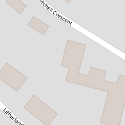

Leaflet © OpenStreetMap contributors
The heatmap indicates the level of crime in the area. The color of the heatmap indicates the crime severity and recency.
Metrics Year-on-Year
- Average area value
- 176,863.00 £Decreased by 32.29 %
- Average area rental value
- 1,300.00 £/moIncreased by 57.00 %
- Est rental Yield
- 8.82 %Increased by 132.11 %
- Crime Rate
- 2.00 %Unchanged by 0.00 %
from 261,208.00 £
from 828.00 £/mo
from 3.80 %
from 2.00 %
Nearby Schools
| Name | Type | Ofsted | Distance |
|---|---|---|---|
| English Martyrs' Catholic Primary School | Voluntary Aided School | Good | 0.41 KM |
| Hatton Hill Primary School | Community School | Good | 0.62 KM |
| St Philip'S Church Of England Controlled Primary School | Voluntary Controlled School | Good | 0.69 KM |
| Our Lady Queen Of Peace Catholic Primary School | Voluntary Aided School | Good | 0.86 KM |
| St Elizabeth'S Catholic Primary School | Voluntary Aided School | Good | 1.31 KM |
Images
Nearby Streets
| Name | Average Price | Average Sqft | Distance |
|---|---|---|---|
| School Lane | £ 0 | 0 | 0.00 KM |
| Oxford Avenue | £ 0 | 0 | 0.00 KM |
| Moss Lane | £ 165,000 | 0 | 0.00 KM |
| Selsey Road | £ 0 | 0 | 0.00 KM |
| Wood Street | £ 145,000 | 0 | 0.00 KM |
Nearby Transport
| Name | NLC | TLC | Distance |
|---|---|---|---|
| Seaforth And Litherland | 2250 | SFL | 1.19 KM |
| Bootle New Strand | 2195 | BNW | 2.36 KM |
| Waterloo (Merseyside) | 2133 | WLO | 2.98 KM |
| Bootle Oriel Road | 2239 | BOT | 3.09 KM |
| Orrell Park | 2247 | OPK | 4.13 KM |
Nearby Listings
| Address | Price | Type | Score | Distance |
|---|---|---|---|---|
| Norwood Avenue, Litherland, Merseyside, L21 | £ 245,000 | BUY | 6 / 10 | 0.10 KM |
| Norwood Avenue, Litherland, Merseyside, L21 | £ 249,950 | BUY | Unknown | 0.10 KM |
| Norwood Avenue, Litherland, Merseyside, L21 | £ 165,000 | BUY | 5 / 10 | 0.10 KM |
| Edgar Court, Sefton Road, Litherland, Liverpool, L21 | £ 200,000 | BUY | Unknown | 0.13 KM |
| Sefton Road, Litherland, L21 | £ 250,000 | BUY | 8 / 10 | 0.22 KM |
Nearby Properties
| Address | Price | Distance |
|---|---|---|
| 23 Mitchell Crescent | £ 155,000 | 0.00 KM |
| 43 Mitchell Crescent | £ 151,000 | 0.00 KM |
| 45 Mitchell Crescent | £ 190,000 | 0.00 KM |
| 4 Mitchell Crescent | £ 74,950 | 0.00 KM |
| 27 Mitchell Crescent | £ 120,000 | 0.00 KM |